Best RV Road Trips in the USA: 15 Scenic Routes

The best RV road trips are not simply the prettiest lines on a map. A route has to fit your calendar, your campground needs, and the whole connected length of your rig. A 127-mile Alaska highway can take longer than expected. A 469-mile parkway can become a bad choice because of one tunnel.
This guide compares 15 routes by mileage, trip length, rig fit, season, reservation model, service planning, and the road issue most likely to change your day. Use it to build a shortlist, then use the ONNAIS RV Travel Guide to match the trip to your broader travel season and budget.
Source and condition check: August 22, 2026. Road closures, wildfire and flood conditions, campground inventory, fuel businesses, shuttles, and reservation rules can change after that date. A live map result is not proof that a road is suitable for your RV.
Download the printable RV Route Reality Matrix CSV.
Compare the 15 Best RV Road Trips at a Glance
The table is the fast shortlist. Mileage marked official comes from the route owner or destination authority. Mileage marked custom depends on the listed waypoint order and must be recalculated with your exact campgrounds. Rig grades apply to the main corridor, not every overlook, campground loop, beach road, or historic alignment.
Best by trip type: Under 7 nights, start with Seward Highway, Badlands and Black Hills, or the Florida Keys. San Juan Skyway also fits the calendar, but it is a D-grade mountain route for experienced, fully checked setups. No route is an automatic big-rig pass. Natchez Trace may work only within its 55-foot combination-length and 14-foot height limits, plus local clearances. Choose Oregon or California for coast, Mighty 5 or Yellowstone for national parks, New England for fall, and the Keys for winter sun.

| Route | Region | Start and End | Route Miles | Comfortable Nights | Best Season | Rig Fit | Reservation Model | Service Planning Note | Primary Road Watch |
|---|---|---|---|---|---|---|---|---|---|
| Historic Route 66 | Midwest and Southwest | Chicago to Santa Monica | 2,400+ NPS corridor to Los Angeles; custom Santa Monica extension | 14-21 | Late spring or early fall | D | No corridor-wide window | Check chosen alignments | Heat, storms, rough historic pavement |
| California Highway 1 | California coast | San Diego to San Francisco | 608 official itinerary | 7-10 | Spring or early fall | C on constrained coast segments | Operator-specific | Verify every coast leg | Closure, landslide, wildfire, fog |
| Oregon Coast Scenic Byway | Pacific Northwest | Astoria to Brookings | 363 official | 7-10 | Summer to early fall | B | State parks open 6 months | Main towns recur; check spurs | Wind, fog, slides, winter storms |
| Washington Cascade Loop | Washington | Counterclockwise loop from Everett | 440 official | 7-10 | July to mid-September | B | WA parks up to 9 months | Confirm mountain legs | Seasonal pass closure, smoke, grades |
| Olympic Peninsula Loop | Washington | Port Angeles loop via Hoodsport | 341 custom map baseline | 6-9 | July to September | B main loop, C for spurs | Campground-specific releases | Check west-side legs | Rain, washout, tide, wildlife |
| Seward Highway | Alaska | Anchorage to Seward | 127 official | 3-5 | June to August | B | Some forest sites 180 days | Confirm Girdwood, Moose Pass and Seward | Crosswind, rockfall, wildlife, snow |
| Utah Mighty 5 | Utah | Moab to Zion itinerary | 1,040 official itinerary | 10-14 | Spring or fall | C | Campground-specific | Recheck desert legs | Heat, flash flood, snow, shuttle changes |
| Yellowstone and Grand Teton | Wyoming and Montana | Jackson and park loop | 316 custom map baseline | 7-12 | Late spring to early fall | C | Many sites up to 6 months | In-park services are seasonal | Wildlife, construction, smoke, snow |
| Black Hills and Badlands | South Dakota | Rapid City loop | 219 custom map baseline | 5-8 | Late spring or early fall | A main roads, D constrained scenic roads | Custer opens 1 year | Plan Rapid City, Wall and Custer | Tunnels, hail, wind, wildlife |
| San Juan Skyway | Colorado | Durango loop | 236 official | 4-7 | July to September | D | CO state parks 6 months | Top off in major loop towns | Grades, brakes, rockfall, fast weather |
| Great River Road | Central United States | Minnesota to Gulf of Mexico | Roughly 3,000-mile corridor; 149/123/178 custom regional baselines | 21-35 | Late spring or early fall | B | No corridor-wide system | Fix the bank and crossings | Flooding, ferries, bridges, heat |
| Blue Ridge Parkway | Appalachians | Section trips only as of Aug. 21, 2026 | 469.1 official full corridor | 8-12 | Late spring to fall | D | NPS up to 6 months | No fuel on parkway | Tunnel clearance, fog, grades, active closures |
| Natchez Trace Parkway | Southeast | Natchez to Nashville | 444 official | 6-9 | Spring or fall | B | NPS sites first-come; peak months fill quickly | No food, fuel or lodging on parkway | Wildlife, cyclists, storms, night driving |
| Florida Keys Scenic Highway | Florida | Key Largo to Key West | 110 official | 4-7 | December to April | B | Florida state parks: residents 11 months, others 10 | Verify RV access at service stops | Tropical weather, crosswind, flooding |
| New England Fall Foliage Loop | Northeast | Boston loop | 898 custom map baseline | 10-14 | Late September to mid-October, variable | C | Acadia 6 months plus 14-day release | Check seasonal businesses | Clearance, traffic, frost, storms |
Rig-fit legend
- A, broad-fit main corridor: Common RV classes can use the main road, subject to current restrictions and campsite dimensions.
- B, small or mid-size preferred: Larger rigs need deliberate planning for campgrounds, towns, parking, and side roads.
- C, base camp plus toad recommended: Keep the RV on the approach corridor and use a smaller vehicle for constrained scenic sections.
- D, advanced check required: Verify height, length, width, loaded weight, grade, braking, turn radius, and current agency restrictions before committing.
Limit of this comparison: The reservation column reports published operator rules, not measured campground availability. Fuel spacing changes with the chosen alignment, campground address, fuel type, and business status. Confirm both before committing to a transfer.
Which RV Road Trip Fits Your Rig and Schedule?
Choose in this order. It keeps the dream in the plan without letting the dream drive the bus.
- Start with nights, not miles. For 3-5 nights, look at Seward Highway, the Florida Keys, or one regional section of a longer route. For 7-10 nights, consider Oregon Coast, Olympic, Cascade Loop, Badlands and Black Hills, or Natchez Trace. Two weeks opens Route 66 sections, Mighty 5, Yellowstone and Grand Teton, or New England. Three or more weeks makes the full Route 66 or Great River Road realistic.
- Match the rig-fit grade. A Class B camper van has more options on town streets and overlook roads. A long Class A motorhome or fifth wheel should favor A and B corridors, then use base camps for C routes. Grade D is a technical decision, not a dare.
- Choose the scenery and the driving job together. Coast routes bring wind, fog, closures, and tight parking. Mountain routes add grades, brakes, tunnels, snow, and smoke. Historic roads may be easier on elevation but harder on pavement and navigation.
- Check reservation tolerance. If you dislike booking far ahead, do not build the whole vacation around one irreplaceable site in the Florida Keys, Yellowstone, or peak-foliage New England. Favor routes with several gateway towns and private alternatives.
- Keep one clean fallback. Every RV road trip should have a route you can still enjoy if a pass, coast segment, campground, or park road closes.
For a first major trip, consider Natchez Trace or an Oregon Coast section. A travel trailer, Class C motorhome, or camper van still needs measured-clearance checks; RV vacation ideas only become routes after that work. Families should also review current RV safety tips for families, especially around heat, wildlife, water, and long transfer days.
How We Selected and Checked These RV Routes
These are RV-friendly road trips only after the actual rig and the actual day are checked. The selection method is straightforward:
- Start with a definable corridor. Each route has an official road, signed byway, park corridor, or reproducible waypoint sequence. We did not use a loose regional label and call it an itinerary.
- Separate official distance from custom mileage. Official figures stay attached to the named corridor. Custom loops list the waypoint order and tell you to recalculate from campground to campground.
- Rate the road and the side trips separately. A Class A motorhome may fit the main highway and still have no business on a tight overlook road. Rig length, tunnel clearance, grades, campsite dimensions, and parking all count.
- Treat booking and services as dated evidence. Campground reservations, fuel stops, propane, dump stations, repair shops, and cellular coverage change. When the source set did not support a corridor-wide number, the article says so.
- Give current road owners the final word. State DOTs, the National Park Service, official byway authorities, posted signs, closures, and law-enforcement directions outrank any RV GPS, blog, or saved route.
This is a route-selection guide, not proof that every listed road is open or suitable today. Seasonal road closures can break a loop. Wildfire, flooding, landslides, construction, and tropical weather can move faster than an editorial update. Recheck immediately before every transfer day.
15 Best RV Road Trips in the USA
1. Historic Route 66: Chicago to Santa Monica
- Route and mileage: Chicago, Springfield, St. Louis, Tulsa, Oklahoma City, Amarillo, Santa Fe, Albuquerque, Gallup, Flagstaff, Kingman, Needles, Barstow, Los Angeles, and Santa Monica. The National Park Service describes Route 66 as a 2,400-plus-mile Chicago-to-Los Angeles corridor. Santa Monica is the custom extension. Preserved alignments and modern connectors prevent one honest exact mileage.
- Realistic trip length: 14-21 nights. Add another week if museums, diners, and roadside towns are the point rather than scenery between long drive days.
- Suitable rig: D. Use Interstate bypasses for big rigs. Check each historic segment, town street, bridge, and pull-off because Route 66 is not one continuous signed road.
- Best season: Late spring or early fall. You trade summer desert heat for a greater chance of shoulder-season storms or cold at elevation.
- Booking lead time: No single route-wide reservation window applies. Check each operator's calendar and local event dates before fixing the trip around one campground.
- Service gap: After choosing the historic segments and Interstate alternates, mark two usable fuel stops for every western transfer and confirm diesel or propane where needed.
- Safety and road watch: Heat, severe storms, active road work, degraded pavement, and an app sending a long RV onto a photogenic but poor historic segment.
The towns matter as much as the road. Choose a few historic segments in each state, then use modern connectors when the old alignment gets narrow, rough, or awkward for fuel.
Anchor stops: Springfield, Illinois; Oklahoma City; Flagstaff and the Arizona high country.
Skip or reroute when: The alignment is unsigned, deteriorated, restricted, flooded, or wrong for the measured rig. Nostalgia does not straighten a narrow bridge.
2. California Highway 1: San Diego to San Francisco
- Route and mileage: San Diego to San Francisco using the Visit California Highway One Classic baseline: 10 stops and 608 miles. Optional inland detours are separate.
- Realistic trip length: 7-10 nights. A slower 12-night version leaves room for weather, traffic, and a base-camp day.
- Suitable rig: C on constrained coastal sections. Use larger-road approaches for the RV and a toad or tow vehicle for tight viewpoints and any segment that does not match the rig.
- Best season: Spring or early fall, with a tradeoff between coastal fog, crowds, heat inland, and changing fire conditions.
- Booking lead time: California State Parks uses a six-month rolling reservation window for many sites. Federal, county, and private operators differ, so open the exact campground calendar before setting transfer dates.
- Service gap: No fixed number is published here. Confirm fuel, diesel if needed, propane, and a legal turnaround on each planned leg before you leave the prior campground.
- Safety and road watch: Landslides, wildfire, closure, fog, crosswind, cliffside driving, and limited places to turn a long combination around.
On August 22, 2026, the Caltrans State Route 1 condition page was reporting an active wildfire-related closure. That report can change quickly, but the lesson holds: never assume the classic itinerary is a continuous through-route because an older article says it is.
Anchor stops: Santa Barbara; Monterey Bay; San Francisco.
Skip or reroute when: Caltrans shows a closure, the campground gives an approach that conflicts with your route, or the driver is not comfortable holding lane position on a narrow coastal section.
3. Oregon Coast Scenic Byway: Astoria to Brookings
- Route and mileage: Astoria, Cannon Beach, Newport, Coos Bay, Gold Beach, and Brookings on U.S. 101. The official Oregon Coast Scenic Byway guide lists 363 miles and 10-12 hours of driving before stops.
- Realistic trip length: 7-10 nights. Five nights is possible, but it turns viewpoints and beach walks into parking-lot decisions.
- Suitable rig: B. U.S. 101 is the main corridor. Town centers, state-park loops, overlook pull-offs, and beach access roads need their own length and turning checks.
- Best season: Summer to early fall for the most forgiving travel window. The tradeoff is heavier campground demand and coastal traffic.
- Booking lead time: Oregon State Parks reservations generally open six months ahead. Other operators use their own calendars.
- Service gap: Coastal towns recur, but a fuel pin is not enough for a long trailer. Confirm two stops with the right fuel, entry, canopy clearance, and exit on every camp-to-camp leg.
- Safety and road watch: Wind, fog, landslides, winter storms, tsunami-zone procedures, and pulling into an overlook that has no clean exit for a trailer.
This is one of the better scenic RV routes for people who want a steady rhythm: move camp, stay two nights, then move again. Larger rigs should leave the coach at camp for tight headlands and small beach roads. Highway-compatible does not mean campsite-compatible.
Anchor stops: Astoria; Newport; the Samuel H. Boardman corridor near Brookings.
Skip or reroute when: Oregon road alerts show a slide or storm closure, high-wind warnings make exposed bridges uncomfortable, or the next park cannot confirm the site and approach dimensions.
4. Washington Cascade Loop: Puget Sound to the North Cascades
- Route and mileage: Counterclockwise from Everett through Monroe, Stevens Pass, Leavenworth, Wenatchee, Lake Chelan, Winthrop and the Methow Valley, Washington Pass, Skagit Valley and Anacortes, Whidbey Island, the Clinton-Mukilteo ferry, and back to Everett. The Cascade Loop Association lists a 440-mile loop.
- Realistic trip length: 7-10 nights. Use the slower end if you want lake, mountain, and island days without moving camp every morning.
- Suitable rig: B. The main state highways work for many rigs, but passes, grades, seasonal State Route 20, ferry dimensions, town approaches, and campground roads still need actual-rig checks.
- Best season: July to mid-September is the practical target, with wildfire smoke, heat, and early weather changes as the tradeoff.
- Booking lead time: Washington State Parks accepts many reservations up to nine months ahead. Federal and private windows differ.
- Service gap: Mountain legs require a fresh two-fuel-option check. Confirm diesel and repairs in the larger gateway towns instead of assuming every tourism stop supports a large rig.
- Safety and road watch: Seasonal pass closure, wildfire, smoke, grades, brake heat, ferry restrictions, and road work.
A seasonal closure on State Route 20 breaks the loop. It is not a small detour. The practical fallback is to keep the western section as a Puget Sound and Skagit trip, or run the eastern section from Wenatchee without claiming you completed the circle.
Anchor stops: Leavenworth; Lake Chelan; Winthrop and the Methow Valley.
Skip or reroute when: Washington transportation alerts show State Route 20 closed, smoke removes the reason for the mountain leg, or the connected rig exceeds a campground or ferry limit.
5. Olympic Peninsula Loop: Rainforest, Coast and Mountains
- Route and mileage: Port Angeles, Lake Crescent Lodge, Forks, Kalaloch Campground, Lake Quinault Lodge, Aberdeen, Olympia, Hoodsport on Hood Canal, and Port Angeles. An August 22, 2026 OSRM/OpenStreetMap car route produced a 341-mile baseline. It is not official or RV-aware. Park spurs and campground transfers are extra.
- Realistic trip length: 6-9 nights. Nine works better if you want both north-side mountains and west-side rainforest without packing up daily.
- Suitable rig: B on the Highway 101 loop and C for several park spurs. The Olympic National Park driving guide makes clear that the park is reached by separate access roads rather than one road through its center.
- Best season: July through September usually offers the most workable combination, balanced against crowds and limited campground choice.
- Booking lead time: Olympic campground releases vary by campground and can include six-month, two-week, and four-day inventory. State and private sites differ.
- Service gap: Before leaving reliable service, confirm usable fuel in Port Angeles and Forks, then check the Lake Quinault-to-Aberdeen plan and save offline directions for the west side.
- Safety and road watch: Heavy rain, washout, road repair, wildlife, tide timing, falling limbs, and weak cellular coverage.
Run Olympic from base camps in a bigger RV. Use the toad or tow vehicle for trailheads and beach roads instead of hunting for a turnaround beside a full lot.
Anchor stops: Port Angeles; the Hoh or west-side rainforest; Lake Quinault.
Skip or reroute when: NPS closes a spur, tides make the beach plan unsafe, or heavy rain changes the approach.
6. Seward Highway: Anchorage to Seward, Alaska
- Route and mileage: Anchorage, Girdwood, Turnagain Pass, Moose Pass, and Seward. The Alaska Department of Transportation lists the Seward Highway at 127 miles.
- Realistic trip length: 3-5 nights. The road is short on paper, but viewpoints, weather, wildlife, and slow traffic can eat the day.
- Suitable rig: B. The highway is the working corridor. Scenic pull-offs, trailheads, and optional Kenai Peninsula spurs still need parking and turnaround checks.
- Best season: June through August for the simplest planning window, with demand, road work, and changing weather as the price of that convenience.
- Booking lead time: Selected Chugach National Forest campgrounds use a 180-day rolling window. Public and private sites differ.
- Service gap: Confirm two suitable fuel options among Anchorage, Girdwood, Moose Pass, and Seward for your fuel type, and make sure each lot can take the full rig.
- Safety and road watch: Crosswind along Turnagain Arm, rockfall, wildlife, snow, congestion, and few convenient alternate routes.
This is a good reminder that mileage is a poor vacation clock. A 127-mile transfer can still deserve a full day. Decide where the rig can safely pull off before the scenery starts, and know the next overnight option before taking an optional spur.
Anchor stops: Turnagain Arm; Girdwood; Seward.
Skip or reroute when: Alaska road reports or weather advisories show conditions that exceed the driver's mountain and wind comfort, or the planned pull-off has no room for the full combination.
7. Utah Mighty 5: Five National Parks in One RV Trip
- Route and mileage: Moab to Zion via Arches, Canyonlands, the La Sal loop area, Monument Valley, Goblin Valley, Capitol Reef and Torrey, Kodachrome Basin, and Bryce Canyon. The Visit Utah Mighty 5 itinerary uses a 10-day, 1,040-mile baseline. Optional side trips stay separate.
- Realistic trip length: 10-14 nights. Fourteen gives weather and rest days while keeping the park sequence intact.
- Suitable rig: C. Use gateway or park campgrounds as bases, then handle constrained scenic roads and shuttle zones in a smaller vehicle where required.
- Best season: Spring or fall. Summer brings serious heat and storm concerns; winter can bring snow and ice at higher parks.
- Booking lead time: Federal, state, and private campgrounds use different release rules. Check each operator as soon as travel dates are fixed, especially when the trip depends on one specific park campground.
- Service gap: Map fuel from the exact park order and campground addresses. Confirm diesel, propane, dump access, and repairs in gateway towns before the gauge makes the decision.
- Safety and road watch: Heat, flash floods, snow, grades, timed-entry or shuttle changes, and campground site limits.
The trick is not squeezing five park signs into ten days. It is keeping transfer days short enough that you can still enjoy the next stop. Large-rig travelers should choose base camps with verified site dimensions and treat park sightseeing as a separate vehicle plan.
Anchor stops: Moab for Arches and Canyonlands; Capitol Reef; a Bryce or Zion gateway base.
Skip or reroute when: Flash-flood warnings are active, a park changes shuttle or entry operations, or the next campground has not confirmed the connected length and approach.
8. Yellowstone and Grand Teton Loop
- Route and mileage: Jackson, Moose, Jenny Lake, Colter Bay, Yellowstone South Entrance, West Thumb, Old Faithful, Madison, Norris, Mammoth, Tower-Roosevelt, Canyon, Lake Village, Fishing Bridge, West Thumb, and Jackson. An OSRM/OpenStreetMap car-route check on August 22, 2026 produced a 316-mile baseline. It is not RV-aware and excludes campground transfers and sightseeing detours.
- Realistic trip length: 7-12 nights. The slower plan reduces repeated packing and leaves room for wildlife delays.
- Suitable rig: C. Make RV transfers between base camps, then use a toad or tow vehicle for most sightseeing days.
- Best season: Late spring through early fall, limited by the Yellowstone road opening and closing schedule, weather, construction, and campground operations.
- Booking lead time: Yellowstone campgrounds generally open on a six-month rolling basis. Grand Teton camping is reservation-only and reservable up to six months ahead.
- Service gap: In-park fuel, food, dump, repair, and cellular service are seasonal and uneven. Check operating dates for every planned stop and keep a gateway-town backup.
- Safety and road watch: Wildlife jams, construction, smoke, snow, thermal-area restrictions, and sudden road closures.
Do not use the RV as a daily sightseeing vehicle unless the specific parking and road plan supports it. Moving a long rig through a bison jam and then searching for a full lot is a poor use of vacation time.
Anchor stops: Old Faithful area; Yellowstone Lake and Canyon; Jackson and the Teton corridor.
Skip or reroute when: NPS reports a road closed, snow or smoke changes visibility, or the campground transfer would put the RV on a constrained sightseeing road at peak traffic.
9. Black Hills and Badlands Loop, South Dakota
- Route and mileage: Rapid City, Ben Reifel Visitor Center, Badlands Loop Road, Wall, Custer, and Rapid City. An August 22, 2026 OSRM/OpenStreetMap car route produced a 219-mile baseline. It is not official or RV-aware. The NPS scenic-driving page lists Badlands Loop Road at about 30 miles, one segment of this trip.
- Realistic trip length: 5-8 nights. Use separate bases near Badlands and Custer if you want fewer long sightseeing days.
- Suitable rig: A on the I-90, SD-240, US-16, and US-385 main corridor. D for Needles Highway and Iron Mountain Road, where official tunnel dimensions include low clearances. Use a Custer or Rapid City base plus toad.
- Best season: Late spring or early fall, trading smaller crowds for the chance of cold fronts and severe weather.
- Booking lead time: South Dakota camping reservations open Custer State Park sites one year ahead, and the agency says many summer weekends fill soon after opening.
- Service gap: Plan fuel and basic services in Rapid City, Wall, and Custer. Do not count on tunnel roads or scenic drives for a comfortable fuel stop in a long rig.
- Safety and road watch: Tunnels, hail, wind, heat, wildlife, severe thunderstorms, motorcycles, and a navigation app treating a famous scenic road like an ordinary shortcut.
Badlands and the Black Hills make a tidy week if the coach stays at camp for the tunnel roads. Use the smaller vehicle for tight curves and busy pull-offs.
Anchor stops: Badlands Loop Road; Wall; Custer State Park and the southern Black Hills.
Skip or reroute when: An official clearance does not leave a conservative margin for your measured height, severe weather is building, or event traffic makes the constrained roads a poor fit.
10. San Juan Skyway, Colorado
- Route and mileage: Durango, Silverton, Ouray, Telluride, Dolores, Cortez, and Durango. The Colorado Department of Transportation lists the San Juan Skyway at 236 miles and about six hours before stops.
- Realistic trip length: 4-7 nights. The slower plan leaves time for weather and lets the driver avoid stacking demanding mountain legs.
- Suitable rig: D. Verify dimensions, loaded weight, braking system, grades, road work, weather, and the driver's mountain experience. A base camp plus toad is the sensible choice for many travelers.
- Best season: July to September, when snow is less likely but thunderstorms, hail, rockfall, and fast weather changes still matter.
- Booking lead time: Colorado Parks and Wildlife camping is reservation-only and opens six months ahead. Other operators differ.
- Service gap: Confirm suitable fuel and repairs in Durango, Silverton, Ouray, Telluride, Dolores, and Cortez. Check hours and RV access before each mountain leg.
- Safety and road watch: Elevation, long grades, brake heat, narrow shoulders, rockfall, snow, exposure, and limited recovery space.
This is the route where scenery can talk a driver into a poor decision. Do not attempt the full loop until the rig and the driver both pass the check. If either answer is uncertain, camp in Durango, Ouray, or another verified base and sightsee in the smaller vehicle.
Anchor stops: Durango; Silverton and Ouray; Telluride area.
Skip or reroute when: Brakes, cooling, tires, weather, road alerts, or driver confidence are not right. There is no prize for finishing a mountain loop in the RV.
11. Great River Road: Minnesota to the Gulf of Mexico
- Route and mileage: Lake Itasca, Minneapolis-Saint Paul, La Crosse, Dubuque, St. Louis, Memphis, Natchez, New Orleans, and the Gulf Coast. The Federal Highway Administration describes a roughly 3,000-mile corridor through 10 states. That is corridor scale, not an exact driven total or one continuous road.
- Realistic trip length: 21-35 nights for the full route. Regional sections make better 7-14-night trips for most vacation schedules.
- Suitable rig: B. Rural corridors are often straightforward, but city approaches, older bridges, ferries, levee roads, and chosen riverbank crossings need separate checks.
- Best season: Late spring or early fall. The tradeoffs are flooding and severe weather in spring, and heat, storms, or early cold depending on latitude in fall.
- Booking lead time: There is no common corridor-wide release window. Check the operator calendar and local event schedule for every overnight stop.
- Service gap: The selected bank and crossings change the itinerary. Fix those choices first, then mark two usable fuel stops, bridge restrictions, and ferry status for each transfer.
- Safety and road watch: Flooding, bridge restrictions, ferry status, farm equipment, storms, heat, and urban traffic.
For a shorter trip, use one of three August 22, 2026 OSRM car baselines: 149 miles from St. Paul through Red Wing, Wabasha, and Winona to La Crosse; 123 from Hannibal through Louisiana, Clarksville, Elsberry, and St. Charles to St. Louis; or 178 from Natchez through Woodville, St. Francisville, Baton Rouge, Gonzales, and LaPlace to New Orleans. These are not official or RV-aware. Follow current signs and flood detours.
Anchor stops: Upper Mississippi bluff country; St. Louis; Natchez and the lower river.
Skip or reroute when: Flood alerts, ferry suspensions, bridge restrictions, or heat conditions change the selected bank. Move to a parallel state or U.S. highway and rejoin later.
12. Blue Ridge Parkway: Virginia to North Carolina
- Route and mileage: Rockfish Gap at I-64 in Virginia to U.S. 441 near Great Smoky Mountains National Park in North Carolina. The National Park Service lists the Blue Ridge Parkway at 469.1 miles.
- Realistic trip length: 8-12 nights. Eight is a steady drive. Twelve gives weather and hiking room without turning every overlook into a five-minute stop.
- Suitable rig: D. The parkway has 26 tunnels. The NPS tunnel-height table lists an edgeline clearance as low as 11 feet 7 inches at Big Witch Tunnel. Clearance changes by tunnel and direction.
- Best season: Late spring through fall. Foliage is popular but brings weekend traffic; spring and shoulder seasons can bring fog, cold, and road closures.
- Booking lead time: NPS parkway campgrounds can generally be reserved up to six months ahead.
- Service gap: NPS states there are no gas stations on the parkway. Choose fuel exits before the day begins and keep enough reserve to reach the backup exit.
- Safety and road watch: Tunnel clearance, fog, steep grades, cyclists, wildlife, weather, and closures with long detours.
Measure the highest fixed point, including rooftop equipment, then check every tunnel in the chosen direction. An RV GPS never overrules a posted sign.
Current continuity note: At 8:00 a.m. on August 21, 2026, NPS still listed full and partial closures, including Hurricane Helene recovery work. Plan section trips until the current closure list confirms continuous access.
Anchor stops: Peaks of Otter; Asheville area; the southern parkway and Cherokee gateway.
Skip or reroute when: Tunnel margin is tight, fog cuts sight distance, or a closure breaks the route. Use parallel highways and base camps.
13. Natchez Trace Parkway: Natchez to Nashville
- Route and mileage: Natchez, Jackson-area parkway stops, Tupelo, northern Alabama, and Nashville. The National Park Service describes a 444-mile recreational road through Mississippi, Alabama, and Tennessee.
- Realistic trip length: 6-9 nights. A slower pace leaves time for history stops without driving rural sections after dark.
- Suitable rig: B. The NPS RV guidance lists a maximum combination length of 55 feet and height of 14 feet. The road is about 11 feet wide with little or no shoulder; some pullouts exclude RVs, and Mangum Mounds has an 11-foot-6-inch bridge clearance.
- Best season: Spring or fall. Summer heat and humidity are the tradeoff for longer daylight; storm systems can affect any season.
- Booking lead time: The three NPS campgrounds are free, have no hookups, and are first-come, first-served. NPS says they can fill quickly in March-April and October-November.
- Service gap: NPS states there is no food, gas, or lodging on the parkway. Fuel, groceries, propane, dumps, repairs, and commercial campgrounds require planned exits. Do not imply that services sit at the next historic pull-off.
- Safety and road watch: Wildlife, cyclists, storms, fallen limbs, limited lighting, rural night driving, and missed service exits.
The Trace works well for drivers who want a quieter road and fewer mountain demands. It still needs discipline. Top off before returning to the parkway, keep the day's historic stops selective, and aim to reach camp before dusk.
Anchor stops: Natchez; Tupelo; the northern Trace near Nashville.
Skip or reroute when: The connected rig exceeds 55 feet, height exceeds 14 feet, storm damage or flooding affects the road, or a missed service stop would force a late arrival. Use a verified exit and rejoin in daylight.
14. Florida Keys Scenic Highway: Key Largo to Key West
- Route and mileage: Key Largo, Islamorada, Marathon, Big Pine Key, and Key West along U.S. 1. The Florida Keys Scenic Highway identifies the Mile Marker 110 to Mile Marker 0 corridor as 110 miles across 43 keys.
- Realistic trip length: 4-7 nights. The short road is not the limiting factor. Campsite inventory, traffic, and where a large rig can park usually decide the pace.
- Suitable rig: B. The main road is the corridor, but site dimensions, bridge crosswinds, parking, turnarounds, and tight campground approaches need care.
- Best season: December through April for cooler and generally drier conditions. Atlantic hurricane season runs June 1 through November 30, and any official evacuation instruction overrides the itinerary.
- Booking lead time: Florida State Parks allows residents to reserve 11 months ahead and nonresidents 10 months ahead. Other operators differ.
- Service gap: The corridor is short, but do not confuse nearby businesses with RV access. Confirm fuel canopy height, diesel lanes, propane, dump access, and a legal turnaround.
- Safety and road watch: Tropical weather, evacuation orders, bridge crosswind, flooding, heat, traffic, and a campground that cannot take the connected length.
Book the campsite before building the rest of this RV road trip itinerary. A short route with no suitable overnight stop is not a plan. Keep official Monroe County, Florida transportation, and weather alerts available on the phone.
Anchor stops: Key Largo; Marathon; Key West.
Skip or reroute when: Local officials issue an evacuation instruction, tropical conditions threaten the travel window, or the campground cannot confirm both site length and approach clearance. Do not wait for a campground office or weather app to overrule county instructions.
15. New England Fall Foliage Loop
- Route and mileage: Boston, Bar Harbor, Conway, Lincoln, Stowe, Manchester in Vermont, Pittsfield, and Boston. The 898-mile OSRM/OpenStreetMap car baseline uses U.S. 302 and about 34 miles of Kancamagus Highway, NH 112, from Conway to Lincoln. Calculated August 22, 2026, it is not RV-aware and excludes optional spurs. Bar Harbor is the Acadia waypoint.
- Realistic trip length: 10-14 nights. Two weeks supports a north-to-south pace without chasing every color report.
- Suitable rig: C. Base-camp the RV, then use a smaller vehicle for foliage roads, covered-bridge approaches, village streets, and busy trailheads.
- Best season: Late September through mid-October is a range, not a promise. Timing changes with latitude, elevation, and weather. Follow current state reports such as the New Hampshire foliage tracker.
- Booking lead time: Acadia camping requires advance reservations. NPS releases 90 percent of sites six months ahead and 10 percent 14 days ahead.
- Service gap: Seasonal businesses can close. Confirm hours before leaving each base and save a backup fuel stop off the scenic road.
- Safety and road watch: Low bridges, grades, early frost, storms, leaf traffic, full parking lots, and seasonal closures.
Do not lock the trip to one supposed peak week. Follow current state reports and keep the base camps flexible. A slower north-to-south plan gives you more chances without a daily color chase.
Acadia oversized-vehicle guidance lists 12-foot-2-inch, 12-foot, and 10-foot-4-inch limits on certain sections. Sand Beach parking excludes RVs and trailers. Camp outside the scenic core and use a smaller vehicle.
Anchor stops: Acadia and Bar Harbor; White Mountains; Stowe and the Green Mountains.
Skip or reroute when: A campground closes for the season, a road does not clear the rig, weather turns, or small-road parking fills.
Turn a Scenic Route into a Bookable RV Itinerary
Once you have two finalists, stop browsing lists and build the trip you can actually reserve.
- Record the rig profile. Note height, width, loaded weight, connected length, tow setup, fuel type, range, and electrical needs.
- Set a driving-day limit. Use fatigue and setup time, not a car-app estimate. Add margin for mountains, coasts, and parks.
- Choose three anchor stops. Reserve the hardest one first and keep the nights between them flexible.
- Check the exact campsite. Confirm site length, approach, turn, overhead clearance, hookups, generator rules, and arrival window.
- Run an RV-aware route. Enter the measured vehicle profile, compare it with current road restrictions, and remember that posted signs win.
- Save Plan B. Keep one alternate campground, a safer route, and a spare night where trouble would hurt most.
The guide on how to plan your RV road trip covers route tools, fuel, campgrounds, budgeting, and a worksheet. This page picks the corridor; that guide builds the daily legs.
Plan Fuel, Propane, Dumps and Repair Stops
There is no universal fuel-stop mileage. Tank size, towing, grades, wind, generator use, traffic, and reserve all change the range. Plan from the actual rig and confirm each business shortly before departure.
| Segment | Miles | Fuel Option 1 | Fuel Option 2 | Diesel | Propane | Dump | Repair | Cellular Note | Last Checked |
|---|---|---|---|---|---|---|---|---|---|
| Camp A to Camp B | |||||||||
| Camp B to Camp C | |||||||||
| Camp C to Camp D |
Use official business pages or call. Confirm the rig can enter and leave; a diesel pump behind a low canopy or in a one-way lot is not a usable stop.
Keep enough reserve to reach the backup after passing the preferred stop. Record propane and dumps separately because fuel stations may not offer them. On remote or seasonal routes, confirm repair capability for motorhomes, trailer bearings, or heavy tires.
Check the Road for Your Actual RV, Not an Average RV
Write these numbers down before checking tunnel clearance, mountain grades, campground roads, or ferry rules.
| Rig Specification | Your Number | Where Measured or Verified |
|---|---|---|
| Total height, including fixed roof equipment | ||
| Overall width, including mirrors where relevant | ||
| Loaded RV weight | ||
| Connected length with tow vehicle or toad | ||
| Tow configuration | ||
| Comfortable fuel range with reserve | ||
| Braking and engine-braking capability | ||
| Turning and backing limits |
Then run the 48-hour recheck:
- Open the official road agency page for every transfer segment.
- Check weather for the road, pass, and destination, not only the campground town.
- Check wildfire, smoke, flood, tropical-weather, or winter notices that apply to the region.
- Recheck every tunnel, bridge, ferry, weight, length, and height restriction against the measured rig.
- Confirm the campground is operating and the final approach has not changed.
- Verify fuel, propane, dump, and repair stops from current operator sources.
- Load the backup route and campground before leaving reliable service.
Do not add inches of optimism to a tunnel check. If clearance is close, use the detour.
Make Campsite Access Easier on Multi-Stop Trips
When travel partners split up, agree on entry before somebody walks off with the only key:
- Shared access: Decide who can enter, how temporary access works, and when a code gets removed.
- Backup entry: Give the mechanical key to a trusted travel partner or keep it in a controlled exterior lockbox designed for that use. Do not use an obvious hide-a-key spot.
- Departure check: Test the lock, check batteries, confirm the backup key, lock compartments, and use the same walk-around every time. Fold this into your regular RV lock maintenance checklist.
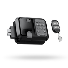
For a compatible door, the ONNAIS Guard Smart RV Keyless Door Lock is an optional campsite-access upgrade. Its keypad avoids passing around one key, while the Bluetooth app shows battery status and creates up to 10 one-time passwords. A mechanical key remains the backup. Four AA batteries are required and not included.
It is not universal. The current fit requirements include a 3.75-inch by 2.75-inch cutout, 1.25-1.5-inch door thickness, 1.5-inch latch opening distance, compatible geometry, and a right-hinged entry door. It excludes Class A RVs, Class C two-pin door types, and left-hinged doors. Check whether an RV door lock will fit before ordering.
Bluetooth is not internet-remote control, and a keyless RV lock does not make an RV theft-proof. It controls one entry point. Pair it with sensible parking, compartment security, lighting, and broader RV security tips.
RV Road Trip FAQs
What is the best RV road trip for beginners?
The Natchez Trace or a short Oregon Coast section is a sensible starting point. Both support a manageable pace and several stopping choices, though campsite dimensions, weather, services, and current road restrictions still need checking.
Should I plan RV days by miles or driving hours?
Plan by comfortable driving hours and setup time first, then use mileage as a check. Grades, wind, traffic, fuel stops, parking, and driver experience can make a short transfer fill the day.
Which scenic routes are best for large RVs?
No route is an automatic pass for a large RV. Broad Great River Road sections may work, while Natchez Trace requires a combination no longer than 55 feet, height under 14 feet, and checks for lower local clearances.
How far ahead should I book RV campgrounds?
Use the exact operator's release date. Examples here range from first-come Natchez Trace sites to six months for many park systems, nine months in Washington, 10-11 months for Florida state parks, and one year at Custer State Park.
Can RV GPS prevent every low-clearance problem?
No. RV GPS can reduce routing mistakes, but databases age and vehicle profiles get entered incorrectly. Measure the rig, read current agency restrictions, and obey every posted sign, even when the screen disagrees.
Do I need a toad for these RV road trips?
Not for every route, but a smaller vehicle makes C-grade routes far easier. It keeps the RV out of tight viewpoints, busy trailheads, constrained park roads, and town parking while the campsite stays put.
Pick the Route, Then Check the Reality
Shortlist by season and nights, match the RV road trip route to the actual rig, verify campgrounds and service stops, recheck road conditions, then build each travel day. Return to the ONNAIS RV Travel Guide when you want to compare routes with destinations, seasons, and trip budgets.